
Record Monsoon Flows, Return of Seasonal and Perennial Flows
2021 Water Year Flow365 Annual Report
2021 was a wild year for Tucson’s creeks and rivers, with historically high flows from the 3rd wettest monsoon on record in Tucson! All year long, our Flow365 community scientists were on the scene, capturing flow data for specific streams throughout the Tucson basin. This community science operation is led by a subset of our River Run Network— a group of people working together to restore Tucson's heritage of flowing creeks and rivers.
While county agencies have flow gauges at some points across Tucson to be able to alert the public about flooding, the data our Flow365 volunteers have been collecting since 2016 fills a gap in data by recording gentler flows, capturing how flow starts and stops at different times of year, and helping us understand the unique nature of our desert rivers and how they respond to changes in precipitation and groundwater levels. Our Flow365 monitors are in the field collecting flow data on a regular basis, at least once a month, but often weekly or even daily during periods of changing flow. Over time, this data also helps us determine the impact of collective conservation actions on creek flow, as we strive towards our long-term goal of restoring Tucson’s heritage of flowing creeks and rivers.
This year’s data tells us we had record flows across the watershed during the monsoon season, including in areas where flow was slow and consistent enough to recharge groundwater aquifers. Our data correlates the flows in our creeks and rivers with rain & snowfall, tracks groundwater levels through a handful of accessible wells, and paints a more complete picture of flow in Tucson’s creeks and rivers. This big picture perspective will help us adapt to climate change, as well as a growing population that places ever higher demands on our regional and local water sources. In both the near and distant future, Flow365 data will help the people of Tucson protect our water, riparian habitats, and the people, plants and animals of the Sonoran Desert.
We’re pleased to publicly share highlights from the data our Flow365 monitors have collected for the 2021 water year, which starts October 1st, 2020 and ends September 30th, 2021. Looking at the water year is a better way to analyze river flow than the calendar year, because it takes into account how the seasonal fluctuations of our winter precipitation and summer monsoons impact flow.
Santa Cruz River
The Santa Cruz River is the main river flowing through Tucson, a binational river that flows both in Arizona and Sonora, Mexico. Flow365 monitors have collected data at over six sites along the river, many of which flow for most of the year as a result of effluent water release. In 2013, the Santa Cruz “A Living River” Project began sending safely treated effluent from Pima County’s wastewater treatment facilities. In 2016, the benefits of this project were revealed when more than 70,000 bird observations and a total of 221 species were recorded in the stretch of the river currently containing water.1 More recently in 2021, Pima County and the City of Tucson agreed to reserve up to 10,000 acre-feet of effluent each year (through the Conservation Effluent Pool) for the sole purpose of maintaining the restorative flow, in recognition of the river’s vulnerable species and the riparian habitat this water has created. Knowing that the Santa Cruz River will continue to flow reliably is a cause for celebration, and demonstrates the power of recycling water.
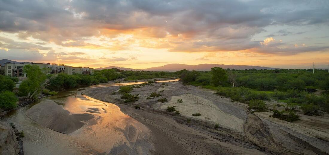
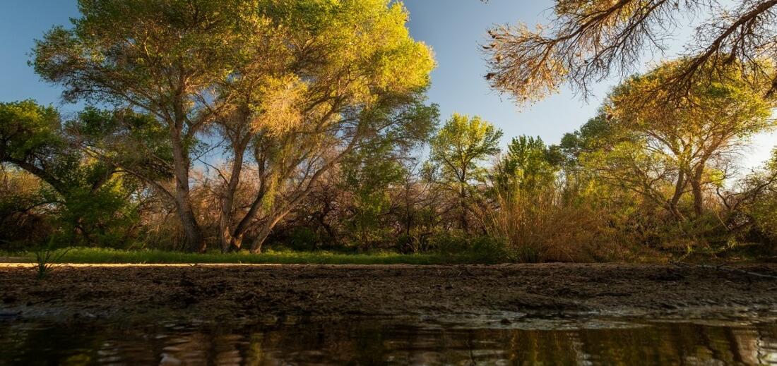
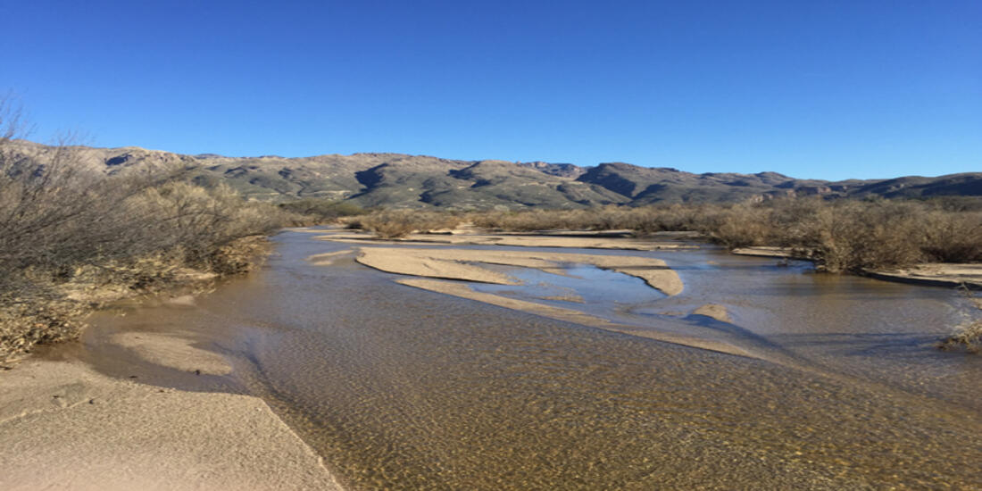
Flow365 Site: Santa Cruz River at Marana Heritage Park
2021 Water Year Flow: 365 Days
2020 Water Year Flow: 365 Days


This beautiful area along the Santa Cruz River has been flowing perennially with the release of effluent flow from the Tres Rios Water Treatment Plant for years now. It creates a ribbon of green - the river’s banks are lined with abundant vegetation, and the area is home to wildlife like coyotes, bobcats, and rabbits. At a recent creek walk, WMG staff and River Run Network community members were able to catch insects and fish from the water. We also found tracks of birds and javelina, and evidence of cattle in the area. This area is open range, but cattle in creek areas can have adverse effects on the habitat - their poo, stomping, and grazing can quickly degrade the water quality and the riparian area.
Volunteer Kathy Balman has been monitoring this area since early 2020, and she has seen some amazing changes in this waterway. With the abundant monsoon rains from 2021 and the rise in flow, the plants in the area are flourishing - in the photos, you can see the change in the amount of vegetation as well as the color.
Sabino Creek
Our monitors observe several sites at the base of the Catalina Mountains. On the east side of Tucson, our monitors capture data from Bear Creek and Sabino Creek. These creeks start in the mountains, with rain and snowmelt feeding surface flows. When the creeks move into the valley, there are some places with shallow groundwater aquifers that support surface flow in addition to rain and snowmelt.
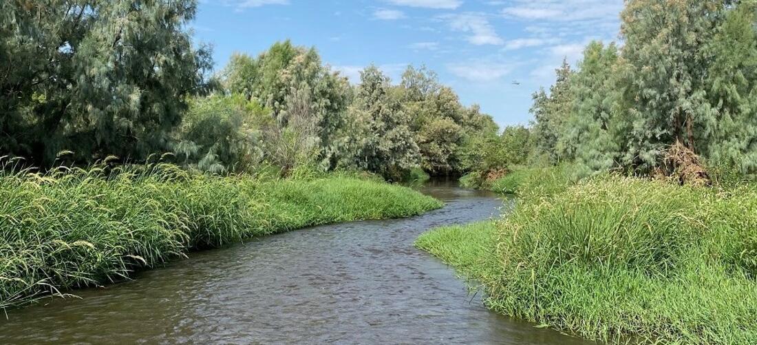
Flow365 Site: Sabino Creek at Wes Miller Park
2021 Water Year Flow: 365 Days
2020 Water Year Flow: 365 Days


Our monitors’ data has shown that a quarter-mile of Lower Sabino Creek has been flowing nonstop since 2016. Lower Sabino Creek is privately owned by a variety of landowners, mostly residential. Used and preserved by the community around it, we have captured data since the start of our program with permissions from the surrounding private landowners and the homeowners association. The restored perennial flow is likely the result of a reduction in groundwater pumping—which over the past decade has ceased at several major pumping sites including a nearby horse ranch owned by the University of Arizona. This area is monitored by Wendy Beall, who has been a monitor in the program since 2020. She has caught some incredible wildlife along this site; most recently, we learned that this area is great for our bat population in Tucson! Bats who live in the canyons close by will use this area for drinking and eating, catching everything from mosquitos to fruit that can be found in the riparian environment.
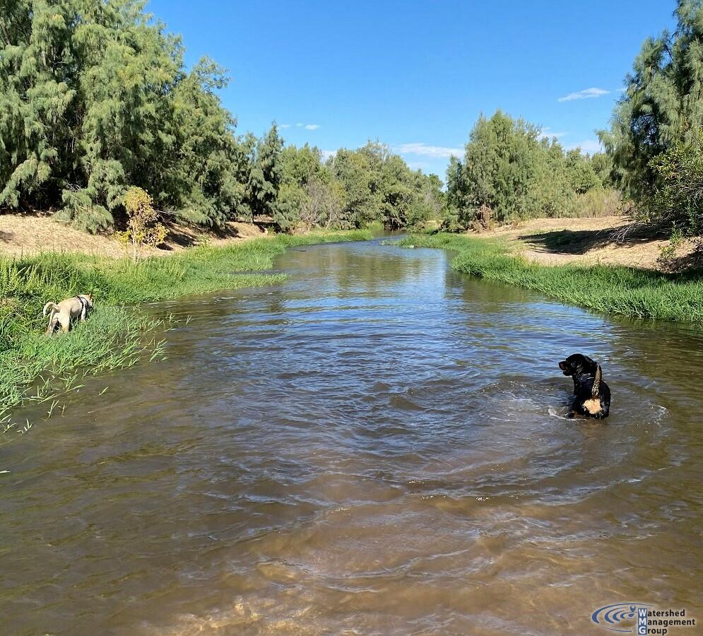
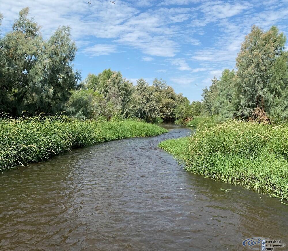
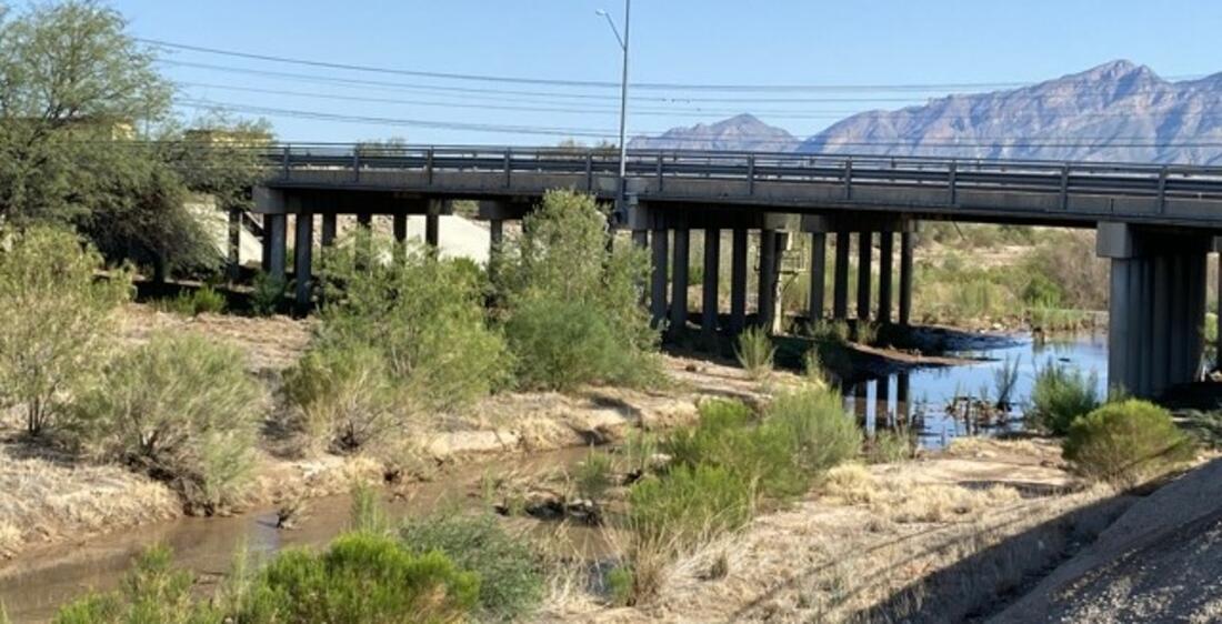
Rillito River
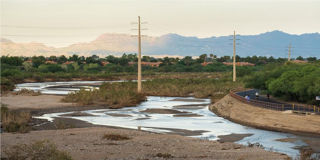
Because of The Loop path and many parks along its banks, the Rillito River is popular with the Tucson community as a green corridor to walk, run, bike, and picnic. The Rillito river is fed by the Tanque Verde and Pantano Creeks, flowing from east to west, eventually connecting with the Santa Cruz River and flowing north. The Rillito River is also known for a large bat population, the Mexican free-tailed bats, that live in large colonies under several bridges that cross the river.
Flow365 Site: Rillito River at Craycroft Rd
2021 Water Year Flow: 83 Days
Most Consecutive Flow Days: 56 days


This site is the confluence of the Tanque Verde Creek and Pantano Creek and is considered a shallow groundwater area (water within 50 feet of the surface) that still supports some cottonwood trees. Historically this area had year-round flow through a large ciénega (marsh) with a large mesquite bosque (forest), supporting indigenous populations. We saw flow during most of the 2021 monsoon at this location, thanks to strong contributing flows from the Tanque Verde Creek as well as the Pantano Creek.
This site is monitored by many of our Flow365 Monitors. Volunteers Mike Campbell, Marcia Lambert, and Catlow Shipek captured the photos you see here.
Flow365 Site: Rillito River at Country Club Rd
2021 Water Year Flow: 42 days
Most consecutive flow days: 23 days


This site is in the middle stretch of the Rillito River, meandering through central Tucson. Its banks are lined with concrete, but its bottom is sandy, allowing a variety of riparian vegetation to grow in the river bed itself. Many Tusconans use the Rillito recreationally, especially along The Loop. There are many cyclists, walkers, runners, and equestrians on the Loop and in the river bed who enjoy the space, with and without water. Water does flow subsurface here, but is not within 50 feet of the river bed, so it cannot support riparian trees like Cottonwoods. Historically this area had shallow groundwater and would have supported seasonal flows.
This site is monitored by many of our Flow365 Monitors. WMG founders and Flow365 Volunteers, Lisa and Catlow Shipek, captured the photos you see here.
Tanque Verde Creek
Historically, stretches of the Tanque Verde Creek were often flowing, either seasonally or year-round. But for decades it has been drying up, with the loss of seasonal and year-round flows due to depleted groundwater levels. This area is home to an incredible array of riparian plant and animal species that are native to the Sonoran Desert. Unfortunately, it has more recently become home to an invasive species called Arundo donax. This highly flammable weed crowds out native plants and habitat, and has made its home in the creek and many other places in our watershed. Through WMG’s River Run Network, we are working to remove this species along stretches of Tanque Verde Creek. Learn more about our efforts here.
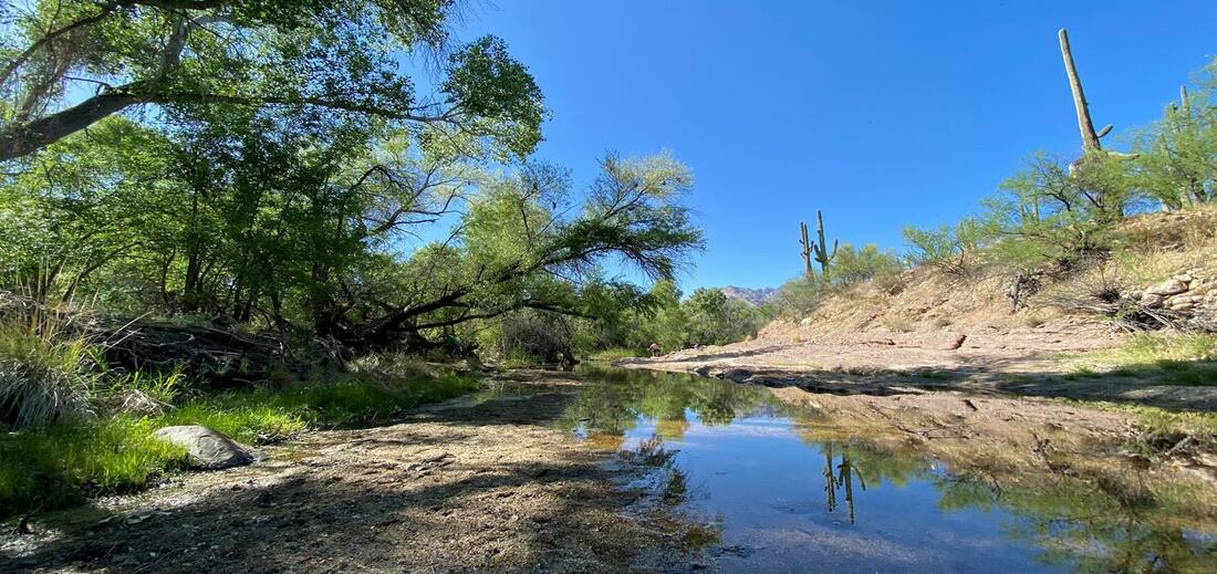
Flow365 Site: Tanque Verde Creek: Wentworth Bosque
2021 Water Year Flow: 70 Days*
Most consecutive flow days: 70 days, July 23, 2021 – Sept 30, 2021*


This middle stretch of the Tanque Verde Creek is an area that likely had perennial flow historically. The nearby golf course that was pumping groundwater switched to reclaimed water in 2005, and since then the aquifer has been steadily recovering, and seasonal flows have been emerging. This shallow groundwater area now supports a riparian forest with cottonwoods, willows, and mesquite trees. WMG first learned about the return of seasonal flows in this area in June 2019, from a neighbor living along the creek. Our monitor at this site, Sara Birtalan, has been instrumental in providing monitoring, including both # of days of flow and flow extent.
*The flow in this area continued through May 6th, 2022, a total of 288 days of consecutive flow.
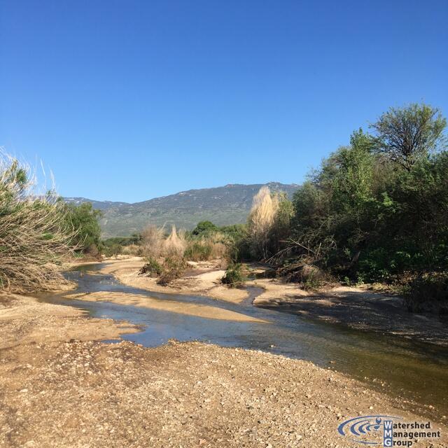
Agua Caliente Creek
North of Tanque Verde Creek, at the foot of the Catalina Mountains, Agua Caliente Creek runs just west of Agua Caliente Park and eventually meets up with Tanque Verde Creek. Our monitors have revealed that flow in this area is dependent on rain and snowmelt. The creek is able to meander freely in much of its floodplain, and has more natural flow unlike some of the channelized rivers in the urban core. The creek area is also lined with vegetation that flourished during the 2021 monsoon. You can see the changes in the photos from our Flow365 monitors over time - how the vegetation grew and changed color with all of the flow.
Flow365 Site: Agua Caliente Creek at Ft Lowell Rd
2021 Water Year Flow: 21 Days
Most consecutive flow days: 7 days


One of our most consistently monitored sites is along Ft. Lowell Rd. The creek crosses the road at times during our rainy season. This site experienced higher flow this year thanks to abundant monsoon rains, and our monitor in the area, Adele Y., noted the incredible vegetation growth that resulted from the summer monsoons.
Adele has been part of the Flow365 Monitoring Team since June of 2020, and has consistently been out to her site to capture flow since she started.
Before the monsoons, Adele hadn't seen any flow at her site since late January 2021, further indicating this area’s dependence on rainfall and snowmelt. Her data also indicates that her site is incredibly variable, flowing one day and completely dry the next. This could be signs of infiltration into the ground, especially considering that most of the riverbed consists of porous sand. Though this site has had less than a month of flow in the 2021 Water Year, we are still encouraged to see flow and flourishing plant life in the area.
Pantano Creek
Pantano Creek originates at the confluence of Ciénega Creek and Agua Verde Creek, south of Tucson near Vail. Flow is primarily contributed from Ciénega Creek and secondarily through Rincon Creek, which originates east of Tucson near Rincon Peak. Pantano Creek flows north to join with Tanque Verde Creek at Craycroft Rd, becoming the Rillito River. Although it is fed from two creeks with seasonal and perennial flow stretches, this creek rarely flows, as the water typically sinks into the ground before it can flow over the surface into Tucson. Though there is not much flow observed from this creek, and it is still disconnected from its floodplain, the creek has a beautiful meandering pattern when it does flow, emulating the natural course a desert river takes.
Flow365 Site: Pantano Creek at Broadway Blvd
2021 Water Year Flows: 46 Days
Most consecutive flow days: 23 Days


This site along the Pantano Creek has been consistently monitored since 2019. Though this area rarely flows, our monitors have done an excellent job at capturing the days when there is water in the creek. In the 2020 Water Year, a record dry year, they captured 27 days of flow at the Pantano River at Broadway Blvd. However, this water year we recorded 46 days of flow at this site, almost double the year before. This helps us see that this area is very dependent on rain and snowmelt, only flowing in response to a precipitation event.