Our Heritage of Flowing Rivers
Tucson’s rivers have changed dramatically in the last 100 years. This map shows where rivers are flowing year-round, seasonally, and only after rainstorms. Comparing the two maps, it is evident we have lost many of our year-round and seasonal flow reaches. As part of our watershed planning and river restoration work, it is critical for us to understand historic conditions as we make decisions about where we want to focus our efforts and what we are ultimately trying to restore. While we will never recreate historic conditions, we can define a new future where flowing rivers are an essential part of our desert cities
The Ever-Changing Santa Cruz River
From early to mid-1900s, these creeks and rivers dried up due to extensive groundwater pumping. Among the pressures on groundwater were growing population and associated urban development, mining, and agriculture. [1] Today, most of these creeks and rivers flow only after heavy rains, with just a few patches of perennial stretches. In our Fall 2019 newsletter, we illustrated where rivers and creeks are flowing year-round, seasonally, and only after rainstorms. [1] Glennon, R. (2002). How Does a River Go Dry? The Santa Cruz in Tucson. In Water Follies: Groundwater Pumping and the Fate of America’s Fresh Waters (pp. 35–50). Island Press.
1919
2003
1942
1989
Our Memories of Flowing Rivers
Community stories about Tucson's creeks and rivers

Santa Cruz River ~ 1930s
"I lived in a little adobe house that was built by my landlord in the '30s from an adobe pit in the backyard. He had stories about when he lived there in the '30s. The river was flowing the and it was not marshy, but it was lush down there by the river. There were plants and those big reeds, the carrizo." ~ Berta

Santa Cruz River ~ 1950s
"It wasn't running much but they built a little lagoon just south of Congress, and they put in little paddle boats where you could take your girlfriend out there and be romantic in the moonlight. The water was all fed by the Santa Cruz, but it was barely running." ~ John

Rillito River ~ 1994
"There were these big cottonwood trees that got uprooted when the river bank eroded. They were somewhere between four and six feet wide. We were speculating how old these things might be. When my colleague [from the tree ring lab] sampled them, we saw that the trees weren't that old, but they were huge. These trees that grow by the water, wow they really grow fast. Now there aren't that many big cottonwood trees along the Rillito." ~ Gregg
Sabino Creek ~ 1950s
"Sabino coming right out of the mountains up there would just roar, and that was a rocky, stony area. It would change the look of the river when we had big floods. So way back, that water would channel to farmland below, and they would use the old sloughs to drain the water down to where the flatter land was, where they could raise crops. Then that ran into the Rillito and together that became a real water source for the whole city." ~ John
Our Rivers Now
Through our Flow365 Monitoring Program, volunteers across the city collect data on our creeks to help tell the current story of our rivers. With this dashboard, you can see what's happening in our creeks and rivers today, last week, or even over the last year! It is updated any time a community member collects data.
Tucson's River Data
Learn more about our Flow365 Monitoring Program and the data collected by volunteers across the city.
River Restoration Efforts in our Watershed

Middle and Lower Tanque Verde Creek
The River Run Network has focused efforts on removing Arundo donax, an invasive plant species, from this section of our watershed. We have been working in the area since 2021 and have successfully restored 75+ acres of riparian habitat from this shallow groundwater area.

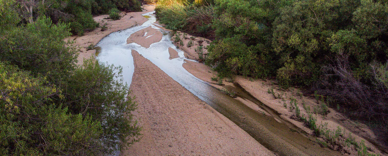
Lower Sabino Creek
This creek has been monitored by our Flow365 Monitoring Program since 2016 and has perennial (year round) flow in a half mile section. We have been working to understand water quality in this area and supporting restoration upstream with rock structures to slow, spread, and sink the flow into the ground and encourage groundwater recharge.

Upper Rillito
Though this area may be dry for much of the year, there is still water beneath the surface. Within 50 feet, to be exact. This shallow groundwater supports cottonwoods, willows, and an elderberry tree grove just upstream of the Craycroft Bridge. We are working in this area to keep it clear of invasive Arundo and support slow, shallow flows that encourage groundwater recharge.

Cienega Creek
From river restoration workshops to supporting the beaver release, Cienega Creek holds an special place in the heart of the River Run Network. This creek is perennial in some stretches, creating important habitat for riparian species like gila topminnow, fireflies, and beavers! We are excited for the beavers that have been released in the area (Fall 2025) to thrive and grow the riparian habitat along the creek.